2017 Year 3 Scouting Report
Old Cascade Crest Hike July 7-10, 2017
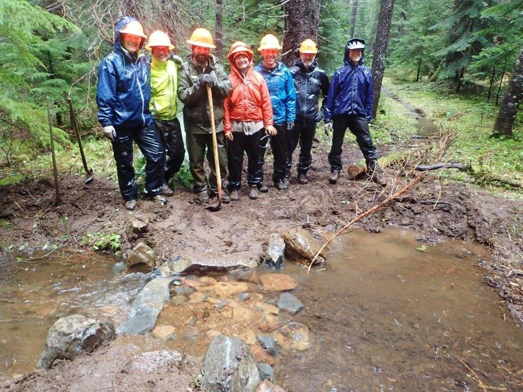
Beth Dayton, Kurt Haas, Kim Lively
Day One: Gordon Peak TH to Pyramid Creek crossing, 9.0 miles
Directions to Gordon Peak TH: From Hwy 22 turn south on Rd 11 (Straight Creek Rd), east of Marion Forks. At 10.4 miles turn left on rd 1152 (no sign). Follow gravel road 1.4 miles to TH sign on left.
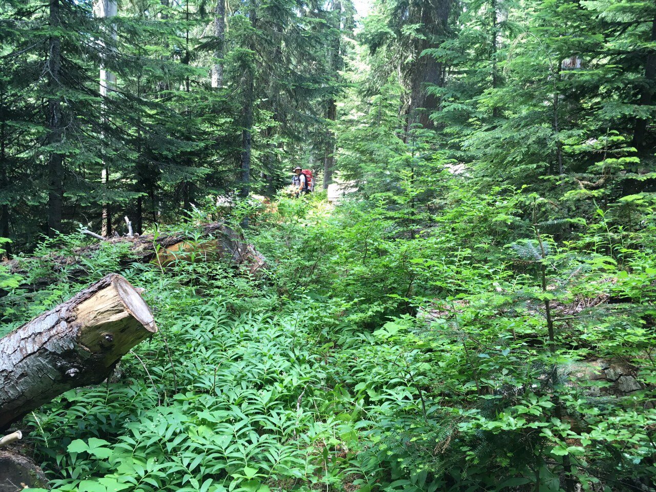
Gordon Pk TH on Gordon Pk Trail 3387, to Jxn with Swamp Mtn Trail 3401: Very brushy, hardly any tread visible in many spots; trail covered with salal, rhodie, huckleberry, etc. 9 logs down, 10-36 inches. Grade mostly 5-8%
Swamp Mtn Jxn to jxn with trail 3382 (wilderness boundary): 36 logs down, intermittently very brushy.
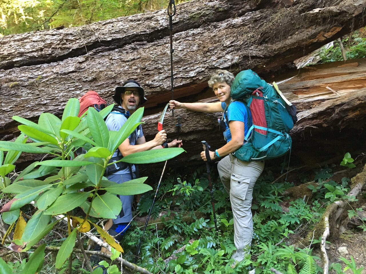
Trail 3382 jxn to wilderness boundary (trail is in Wilderness): 15 logs, multiple old small bridges and boardwalks, intact but decaying.
Wilderness boundary to Pyramid Creek crossing: no logs, trail in better shape. Wet crossing of Pyramid Creek. Two nice campsites on south side of creek, with swimming hole a few hundred feet downstream of crossing.
Day Two: Pyramid Creek to North Crescent Mtn TH, 9.7 miles including detour to Middle Santiam River
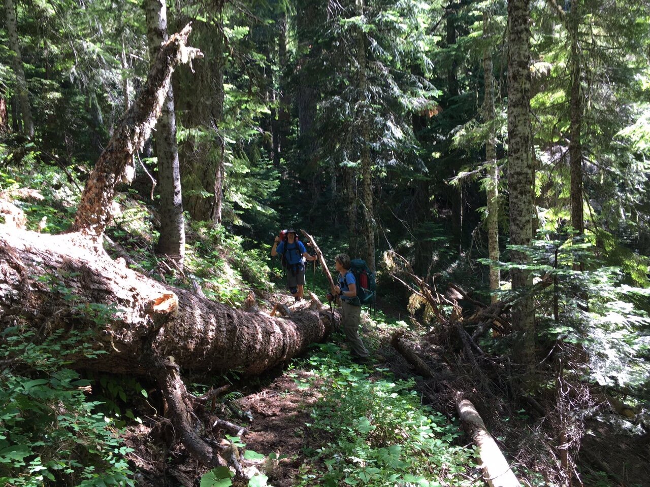
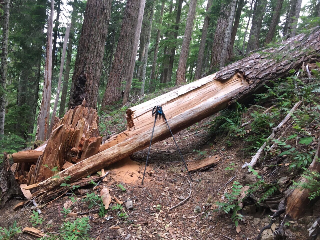
Pyramid Creek to Middle Santiam River Crossing: 14 logs. Not too brushy. Very narrow tread, side hill in places is 60-80% grade. Trail grade 10-20%. Several logs are over 40”
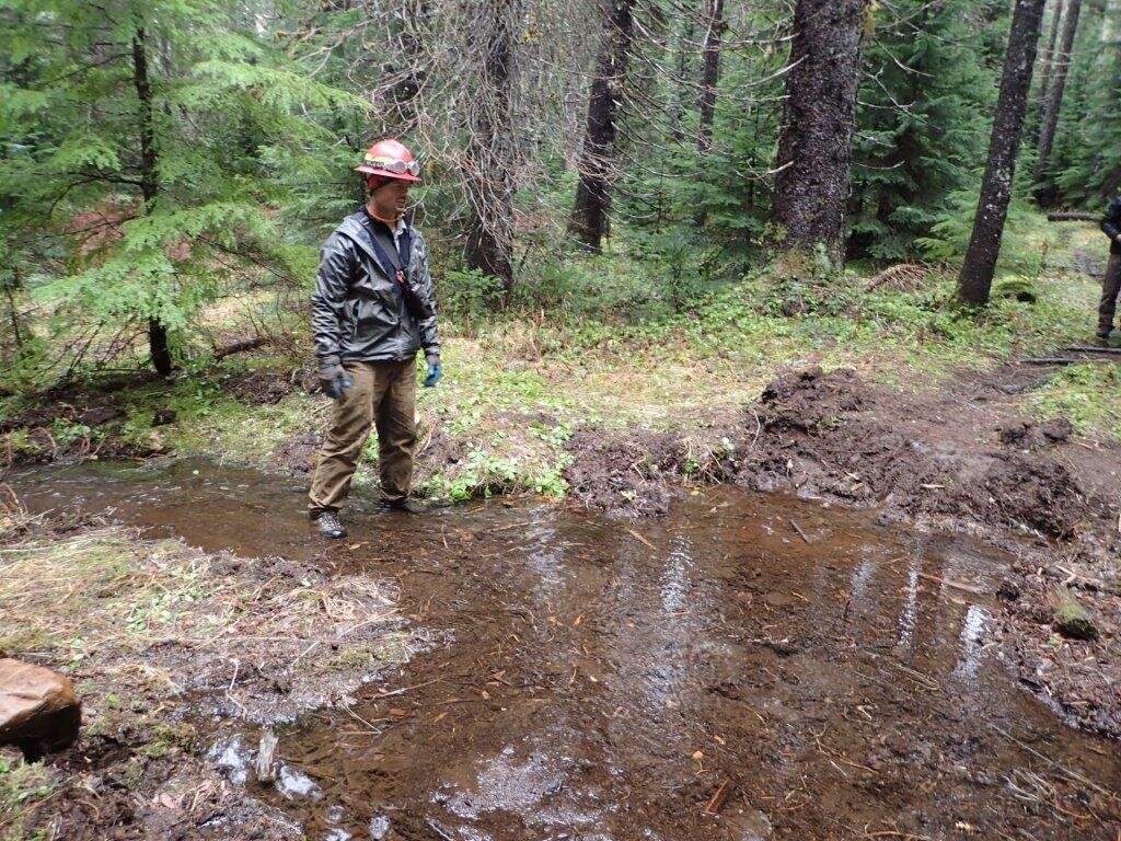
Middle Santiam River: wet crossing. Trail down to river blocked by 30” tree on very steep side hill (100% grade); user trail around tree.
Great swimming hole accessed by steep, brushy user trails on south side of river. No obvious camping spots; could camp on gravel bar.
Middle Santiam crossing to Rd 2049 crossing: confusing intersection labeled Upper Trailhead 3.8 and Shedd Camp 2.4. (trail to Rd 747 TH?). No sign on trail continuing toward Crescent Mtn. Good trail bench 18-24 inches, often 15-20% grade.
Rd 2049 crossing to Crescent Mtn TH: Good bench, 18-24 inches, no brush problems. Logged out fall 2016, but 16 new logs down. One bridge in good condition, one shallow unbridged crossing. Steep grade, 15-20%.
Crescent Mtn TH: good open campsite south of road near Park Creek, good water from creek.
Day 3: Crescent Mtn TH to Parish Lake, 10.1 miles, including attempted bush wack to Daly Lake, and hike to road to Parish Lake TH.
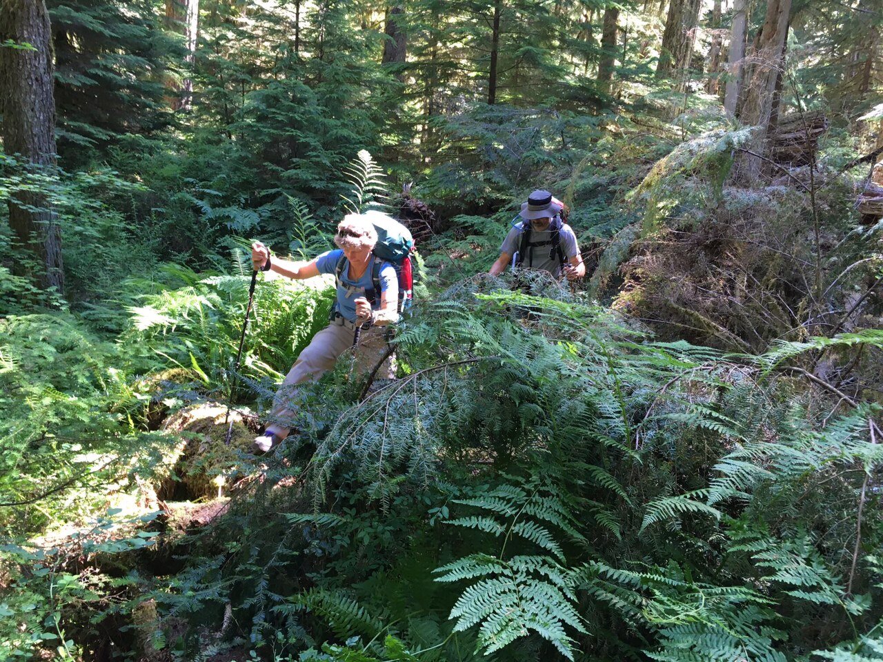
Crescent Mtn TH to Three Pyramids TH (trail 3403): 19 logs, up to 32 inches. Multiple failed culverts, exposed, with erosion. Grade less than 10%. Very brushy.
South side of Three Pyramids Trail (3380): Grades 20-25%, very narrow tread (12 inches or less), rocky, eroded, trenched when on fall line. At least 20 trees, two over 40 inches, several complicated piles. Brushing has been done in first mile (recent) but very brushy another 0.2 miles.
Spur to summit: no logs, bench 12-18 inches. 20% grade or more.
North side of Three Pyramids trail: 55 logs, up to 36 inches. Trail bench 18-24 inches. Several log piles. Grade 15-25%, side hill 60% or more near top, less at bottom (north end).
Road 2047 crossing: no sign on north side of road. Severe erosion with deep trench first 200 yards on fall line. Very brushy. 15 logs from 2047 to creek crossing.
Pyramid Creek crossing: Single log bridge, railing loose and falling off. North of bridge: flat boggy area with extreme brush, over head height, trail tread not visible. Go straight about 50 feet after log bridge, then turn hard left to find a second bridge, and trail appears in woods. No obvious camp spot but good water source.
To camp at Parish Lake: Follow gravel rd 2266 0.75 miles, taking left at road junction. 0.75 miles from TH to lake. Several nice campsites with lake access for swimming. Trail to lake well brushed.
Day Four: Parish Lake to Gordon Peak TH, 10.7 miles.
From first half mile of Scar Mtn Trail, attempted to bush wack to Daly Lake by GPS coordinate. Had to abandon after few hundred yards due to extreme brush and steep side hill. Would be great to have a trail spur to the lake for camping.
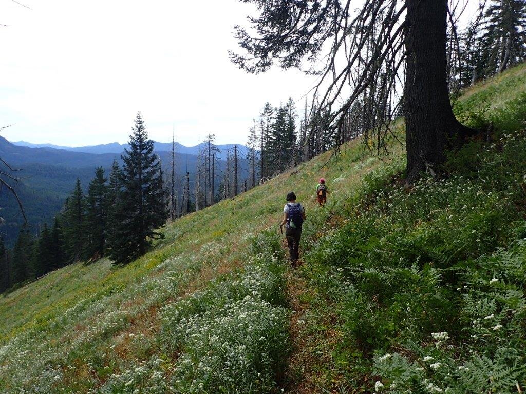
Scar Mtn TH (trail 3402) to top of Trapper Peak: Good tread, 18-24” wide, side hill 60-80% grade, trail 20-25% grade with switchbacks. No brush problems. Very tiny spring in small saddle, barely dripping water. Otherwise NO water from crossing of Pyramid creek previous day to very small springs near Gordon Peak TH. Peek-a-boo view from top of Trapper peak, mostly obscured by brush.
Scar Mtn Trail from Trapper Peak to Scar Mtn summit: very recent log out has been done. Minimal brush. Tread less than 12 inches or non-existent. Great view from ridge at top of Scar Mtn.
Scar Mtn trail from summit of Scar Mtn to Gordon Peak TH: Recent log out continues to connector to 1161 road; from there very brushy, 16 logs to Gordon Peak TH, some over 40 inches; at least one pile-up. Trail on very steep side hill (60-100% grade), minimal to no tread, trail grade 20-25%; flattens out after 1161 connector.